
Barossa and McLaren Vale: Which Side of the Character Preservation District Line Is Your Land On?
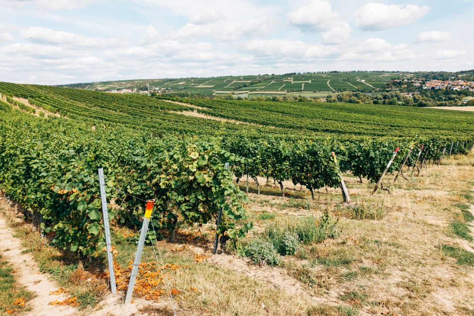
Barossa and McLaren Vale: Where Does Your Land Sit Against the Character Preservation District Line?
General information for South Australian landowners only. This is not legal, planning, valuation or survey advice, and nothing here interprets legislation for your parcel. Route the current wording and effect of the Character Preservation Acts to an SA property lawyer reading the current authorised version, assessment against the Planning and Design Code to a qualified planning consultant, boundary and title queries to a licensed surveyor and Land Services SA, and contracts to an SA property lawyer or conveyancer. Legislation and planning instruments are amended from time to time, so confirm the live position for your own parcel with PlanSA, legislation.sa.gov.au and your own advisers before you rely on anything here.
One line, and where your parcel sits against it
Before you read anything else about creating a new allotment in the Barossa Valley or McLaren Vale, go and check one line.
The question is where your certificate of title sits in relation to the legal boundary of a Character Preservation District. A parcel can sit wholly inside that boundary, wholly outside it, or across it. The mapped lines were not drawn to follow title boundaries, and nothing obliges a given title to fall neatly on one side of one. Where land is inside a district, the same question arises again with the township boundaries drawn within that district: a title may sit wholly within a township, wholly outside the townships, or partly each.
That answer is what tells you whether the rest of this article is about your parcel at all — and it turns on where a boundary falls, not on how strong your case is. Nothing about your site's slope, services, road frontage or neighbouring pattern moves a mapped line. Where those boundaries fall on a given title is established from the current mapping and the title itself, by the people qualified to read both, and not from an article.
A parcel the line runs through is not a footnote to that check, and it is worth planning for rather than assuming away. It changes the question you take to your advisers. It stops being "which side am I on" and becomes which part of my land lies where, how that part is described on the title, and what the legislation and the Code each do with a parcel in that position. That is parcel-specific work: the geometry for a licensed surveyor reading the current mapping against the title, what the relevant Act says about land in that position for your own SA property lawyer, and Code assessment for a qualified planning consultant. It is worth asking for that answer explicitly rather than accepting a yes or no, because a yes or no can quietly assume the simple case.
Two districts exist: one covering the Barossa Valley, one covering McLaren Vale. PlanSA publishes the mapping for both, and the Character Preservation District Overlay in the Planning and Design Code shows how they are picked up in day-to-day assessment (source: PlanSA — Character Preservation Districts). Confirming where a title sits against both the district boundary and the township boundary — including whether either line crosses the parcel rather than passing it by — is work for a licensed surveyor and a qualified planning consultant, reading the current mapping and the title rather than a general-purpose map.
If your land sits wholly outside both districts, this article is not about your parcel, and the sequence goes back to the ordinary questions covered in can I subdivide my block in SA.
The restriction sits in two Acts, not in the Code
Most planning constraints a South Australian owner runs into live in the Planning and Design Code. This one does not.
There are two separate pieces of legislation: the Character Preservation (Barossa Valley) Act 2012 and the Character Preservation (McLaren Vale) Act 2012, each with its own district (source: legislation.sa.gov.au — Barossa Valley, legislation.sa.gov.au — McLaren Vale). Among the things those Acts do, as published, they place limitations on land division within the districts, directed at the creation of additional allotments for residential purposes outside the townships — which is also how the councils covering the districts describe the position to their own applicants (source: Barossa Council — Land division). That is the structure of the instrument. How it lands on a given title is a separate step, and it is the step that has to be confirmed parcel by parcel, because the Acts also carry their own definitions, and those definitions deal separately with some categories of accommodation and some other uses. What those definitions cover, and how they read on a particular parcel — including a parcel the district or township line runs through — is a question for your own SA property lawyer. The conditions themselves are for that lawyer to read in the current authorised version — this article does not paraphrase them, and no summary, ours included, does the work of that reading.
Four terms are worth keeping apart, because they are routinely used as if they were one thing:
A Character Preservation District is a geographic area defined in legislation.
A township is a defined area inside a district, its boundary also drawn by the legislative framework, where the position differs from the surrounding land.
The Character Preservation District Overlay is the layer in the Planning and Design Code through which the districts are carried into ordinary development assessment.
A Code Amendment is the statutory process for changing the Planning and Design Code.
The legal source of the limitation is the two Acts, and PlanSA describes the Overlay as how the districts are carried into Code assessment (source: PlanSA — Character Preservation Districts). The way we read that structure is that the Acts are the source layer and the Overlay is where an applicant meets the districts in ordinary assessment — but that reading is ours, not a judgement on the Overlay's legal effect. Which process could change what, on your parcel, is a question for your own SA property lawyer and a qualified planning consultant.
Why "get it rezoned through a Code Amendment" does not move this line
A Code Amendment is the standard answer in South Australia when land is not zoned for what an owner has in mind. It is a real process with real outcomes, and we set out how it works in how to rezone land in SA through a Code Amendment.
Inside a Character Preservation District, that process is aimed at the wrong instrument. A Code Amendment changes the Code. The district boundaries and the township boundaries are fixed by the legislation, and PlanSA's material describes changing them as a matter for amending the Acts — a parliamentary process, not a planning one (source: PlanSA — Character Preservation Districts). The statutory review of the two Acts reported to Parliament reached the same structural point: proposals to shift the mapped boundaries were treated as requiring further work and, in some cases, other steps first, rather than as something the planning system could simply absorb (source: PlanSA — Character Preservation Acts Review: Review Outcomes Report).
This is where owners understandably get confused, because state-led rezonings do happen in South Australia, and one of them has been running close by. The Concordia Code Amendment proposes rezoning rural land near Gawler for housing; YourSAy records that consultation on the draft has concluded, and that the department will provide the Code amendment and an engagement report to the Minister for Planning for his consideration (source: YourSAy — Concordia Code Amendment). Where that process has reached by the time you read this is worth checking on PlanSA rather than assuming. If you farm near Gawler you will have watched it move.
It is still not a precedent for land inside a Character Preservation District, and the reason is the instrument rather than the geography. A Code Amendment is the instrument for changing the Code. Concordia does not show that a boundary written into a Character Preservation Act can be moved by a Code Amendment, because that is not what a Code Amendment does. The YourSAy material for Concordia also describes the area identified for rezoning as sitting outside the Barossa Valley Character Preservation District, which is consistent with that reading rather than an exception to it. Where a growth area sits and how those state-led arrangements work is a different subject, covered in what the Greater Adelaide Regional Plan means for growth-area landowners. Two things are worth holding onto from the comparison. The neighbouring paddock being rezoned tells you nothing about the land inside the district line. And a rezoning, wherever it happens, does not by itself grant development approval — it changes what may be assessed, and an application still has to be made and determined by the relevant authority.
The state's own forward program for these districts points the same way. PlanSA's material describes the Greater Adelaide Regional Plan as committing to a future state-led Code Amendment concerning the Character Preservation District Overlay and the character values it carries (source: PlanSA — Greater Adelaide Regional Plan). What any resulting amendment would and would not cover is not something this article can determine — watch PlanSA's publications as they are released, and put the question to a qualified planning consultant.
What we see owners in the districts look at next
Saying that the Acts limit new allotments outside the townships is not the same as saying nothing can be done with land in the districts. What Cyberate PM sees owners exploring, once the boundary question has an answer, usually falls into three directions. This is our own grouping rather than an exhaustive list, and each one has to be tested against the current legislation by your own lawyer and against the Code by a planning consultant.
Ordinary land division inside a township boundary. PlanSA and the councils covering the districts describe townships as defined areas inside a district where the position differs from the surrounding land, and the usual South Australian division questions are the ones that come up there — zoning, minimum allotment characteristics, services, access, and the relevant authority's assessment against the Code. Whether that description fits your title, and what follows if it does, is for a licensed surveyor and your own SA property lawyer to establish rather than for this article to assume. Sitting inside a township boundary is not itself an approval; it changes which set of questions you are working through.
Boundary work between existing titles. Realignments between existing titles, and amalgamations of them, are about where lines run rather than about adding a title to the fold. Whether a particular proposal actually produces an additional allotment, and how it is characterised for the purposes that matter here, is a matter for a licensed surveyor and the relevant authority on the facts of the titles in front of them — it is not settled by calling the work a realignment. It is also worth understanding how this kind of work differs procedurally from simply selling off part of what you own; we cover that distinction in selling part of my land in SA. Whether a particular realignment is available on your titles is a question for a licensed surveyor and your lawyer, not something to assume from the shape of the parcel.
Paths that do not depend on a new residential title. Tourism and short-stay accommodation, cellar-door and primary-production-related activity, and other uses that add value to land you keep in one title. The Acts deal separately with some of these categories in their own definitions, and the Code sets out what is assessed where. Both halves of that need checking on the current wording, by your lawyer and a qualified planning consultant respectively. None of these is put forward here as available on any particular parcel — they are subjects to investigate, not pathways this article is in a position to say are open.
What none of these are is a workaround. They are the directions we see owners look at because they are not aimed at creating an additional residential allotment outside a township in the first place, which is a different thing entirely. Whether any of them is open on your land depends on facts about your land and on the advice you take on it.
Which map are you actually on: the districts are not the Environment and Food Production Areas
There is a second instrument that limits land division on the fringe of Greater Adelaide, and it is frequently confused with this one.
The Environment and Food Production Areas are established under the Planning, Development and Infrastructure Act 2016. They have their own mapping and their own review and amendment machinery within the planning system (source: PlanSA — Environment and Food Production Areas). The Character Preservation Districts are established under their own Acts, with their own mapping, and boundary change through a different route again.
The two do not describe the same ground. That matters because an owner who has only read about the Environment and Food Production Areas can reach a confident and wrong conclusion — my land is not in an EFPA, so there is nothing structural in the way — when the constraint on their parcel comes from a Character Preservation Act instead. The reverse mistake happens too.
So the order of questions is: which mapped instruments does my title sit inside, then what changes each of them, then what remains available. Answering the second before the first is how effort ends up aimed at the wrong process.
When a developer knocks, the first question is not the price
Owners in both districts get approached. Sometimes the approach comes with an offer attached, sometimes with a proposal to run a rezoning at the other party's cost.
Before either is worth evaluating, the boundary question needs an answer, because it is the threshold question sitting under the whole proposal. It is not the answer to the proposal. Knowing where the lines fall on your title tells you which instrument you are dealing with and which advisers have to be involved; whether what is being proposed can actually be delivered takes specialist assessment on top of that — the legislation read by a lawyer, the Code assessed by a planning consultant, and the survey position established on the ground. Whether a new allotment can be created is one question; what land is worth is a separate one, and assessing value is work for a licensed valuer rather than for this article or for us. How a developer's number is built backwards from an end value is worth understanding either way, and we set it out in is a developer's offer a fair price. The boundary question is worth answering alongside that arithmetic rather than after it; how you weigh the two against each other is a matter for you, your licensed valuer and your own SA property lawyer.
Cyberate PM is engaged by the owner and does none of the specialist work here. We do not interpret legislation, give legal opinions, search title, survey boundaries, assess against the Code or value land. What we do is coordinate: commission the title and boundary check from a licensed surveyor and Land Services SA, put the legislative question to an SA property lawyer in terms that produce a usable answer, brief a planning consultant on what the Code allows where the legislation is not the obstacle, hold one consistent set of assumptions across all of them, and put the result in front of you as a single decision rather than three unrelated opinions.
Three things are worth doing before you engage anyone at scale:
Have where your title sits confirmed against both the district boundary and the township boundary — through a licensed surveyor and Land Services SA, from the mapping rather than from memory, and ask specifically whether either line crosses the parcel rather than passing outside it.
Ask your own lawyer what the current authorised version of the relevant Act says about your land, and what it does not say.
Ask anyone proposing a rezoning which instrument they are proposing to change, and by which process.
If you own land in the Barossa Valley or McLaren Vale and want the boundary question answered properly before anything else is committed, talk to us.
Frequently asked questions
Does a Character Preservation District mean land in the Barossa or McLaren Vale cannot be divided at all? The question is what the limitation in the Acts is directed at. As published, it is directed at the creation of additional allotments for residential purposes outside the townships — which is also how PlanSA and the councils covering the districts describe the position to their own applicants. Land inside a township boundary is described differently, and so is boundary work between existing titles, though whether a particular realignment or amalgamation results in an additional allotment is a matter for a licensed surveyor and the relevant authority on the facts. Which description fits a given title, and what the current authorised version of the relevant Act says about it, is confirmed for that parcel with the relevant authority, a licensed surveyor and the owner's own SA property lawyer, reading the authorised version against the title rather than a general description of the districts.
Could a Code Amendment move my land out of the district? A Code Amendment changes the Planning and Design Code. On the terms PlanSA publishes, the district and township boundaries are fixed in the legislation, with change requiring amendment of the Acts through Parliament. That is why a rezoning proposal aimed at the Code does not reach the boundary itself. Confirm the current position for your own parcel with a qualified planning consultant and your own SA property lawyer, reading the authorised version.
A Code Amendment near Gawler is rezoning land for housing. Why not my land? A Code Amendment changes the Planning and Design Code. Concordia does not show that a boundary written into a Character Preservation Act can be moved by a Code Amendment, because that is not what a Code Amendment does. A rezoning nearby is not evidence about land inside the district line, and it does not create a pathway that the legislation does not provide.
I have been told I am not in an Environment and Food Production Area. Does that settle it? Not on its own. The Environment and Food Production Areas and the Character Preservation Districts are separate instruments with separate mapping and separate change processes. Being outside one says nothing about the other.
Who can actually tell me where the line falls on my title? A licensed surveyor and Land Services SA for title and boundary, a qualified planning consultant for how the Overlay and the Code apply to the parcel, and an SA property lawyer for what the Act itself says. If the line crosses your parcel rather than passing outside it, the same people answer the question — the answer is simply longer, because it has to deal with each part of the land separately. Cyberate PM coordinates those inputs; it does not produce any of them.
This article reflects publicly available material at the time of writing. Legislation and planning instruments are amended from time to time, and processes affecting these districts are ongoing — confirm the current position against the authorised version of the relevant Act on legislation.sa.gov.au and the latest PlanSA publications before relying on anything here. General information only; not legal or planning advice.
Sources
Expert property development and project management insights.
Not Sure Whether Your Site Stacks Up?
Send us the address and your goal. We will identify the first planning, buildability and feasibility questions before you commit further capital.