
The Fence Is Not the Boundary: What a Surveyor's Pegs Can Do to an Adelaide Subdivision Plan
The Fence Is Not the Boundary: What a Surveyor's Pegs Can Do to an Adelaide Subdivision Plan
General information for South Australian landowners only. This is not legal, survey, planning or financial advice. Boundary position and the marks that define it are the work of a practising licensed surveyor; whether a division concept clears the provisions applying to your address is assessed by a qualified planning consultant against the Planning and Design Code and determined by the relevant authority; title, consents and the effect of any agreement with a neighbour are for your own SA property lawyer or registered conveyancer. Statutory procedures and planning policy change, so confirm the live position for your own parcel with PlanSA, Land Services SA and your own advisers before you rely on anything here.
The morning the pegs went in
It is early on a weekday in an older Adelaide suburb. The licensed surveyor works from the street, puts a peg in near the front corner of the block, walks the length of the property and puts another one in at the rear. Between them the marks describe a straight run down the side of the house.
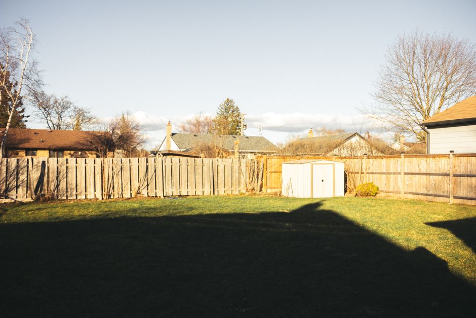
The fence runs down that side too. It is timber, it has been replaced at least once, and it has been where it is for as long as anyone in the street can remember. From the back step you can see the run of pegs and the centreline of the fence sitting apart, with a strip of ground between them.
That strip is the entire subject of this article.
Nobody did anything wrong to produce it. Fences get rebuilt along the line of the fence they replace. Gardens, sheds and driveways get built up against what is there. Over decades in an established suburb, occupation and title become two separate records of the same piece of ground. The title boundary itself does not wander. It sits where the plan and the registry put it under the Real Property Act 1886 (SA), and on the terms the Surveyors Board of South Australia publishes, the marks that define a property boundary may only be placed by a practising licensed surveyor — a fence is not one of those marks, and putting one up does not move the boundary. What can end up somewhere else is the line of occupation on the ground, and the distance between the two can widen quietly each time something is rebuilt along what was already there. The Board puts the consequence plainly: major discrepancies between boundaries and fencing are not uncommon, and can sometimes be very difficult to rectify (source: Surveyors Board of South Australia).
If you are still working out whether your block can be divided at all, start with whether you can subdivide your block in SA. This article is about the site fact that a "yes" rests on.
Which survey you are actually commissioning
Two different pieces of work get called "getting the block surveyed". They answer different questions, and which of them a licensed surveyor recommends at this stage depends on what the parcel and the proposal need.
An identification survey answers where the things already on the ground — the fences, the house, the carport, the driveway, the shed — sit relative to the title boundaries. It produces a plan and a report showing the relationship between what is built and what is owned. It is one of the surveys an adviser may recommend during due diligence before a purchase contract is signed, and it is the one that gives a division concept a measured starting point rather than an assumed one.
A boundary re-establishment survey re-marks the title boundaries on the ground and leaves marks behind. As the Surveyors Board describes cadastral work, it is performed both for the re-establishment of existing property boundaries and for the creation of new property boundaries in the land division process (source: Surveyors Board of South Australia). You arrive at it once a division is real and moving into survey — the stage that ends in a Deposited Plan, the survey plan of the division that is lodged with Land Services SA and deposited in the Lands Titles Registration Office. Land Services SA publishes a guide to that process (source: Land Services SA).
One ordering follows readily from that split, and it is one an adviser may recommend: identification before you inspect or contract on a block, identification again before you draw division lines on a block you already own, and re-establishment later, as part of the division survey itself. Whether it is the ordering for your matter is not ours to say. A licensed surveyor who has looked at your parcel and its plan history may sequence the work differently, and some matters have their own reasons to go straight to re-establishment — so put the sequence above to the surveyor you engage as a question, rather than treating it as the order every block follows. Worth remembering alongside it: a land division approval does not itself bring the new allotments into existence. On the sequence Land Services SA publishes, they come into existence through the plan and the registry steps that follow (source: Land Services SA).
Either way, the work is not open as to who does it. On the terms the Surveyors Board of South Australia publishes, in South Australia all property boundary surveys must be conducted or supervised by a practising licensed surveyor by law, and only licensed surveyors may legally place the marks that define property boundaries — surveys by unlicensed practitioners do not have legal standing (source: Surveyors Board of South Australia). The marks are protected once they are in: deliberately tampering with survey pegs is an offence under the Survey Act 1992 (SA), except as the Act permits (source: Law Handbook SA). Both of those are published positions rather than our reading of them, and the Board publishes the current terms; the surveyor you engage can confirm their own licensing status, and anything touching the marks on your own ground is a question for that surveyor and, if it goes further, for your own SA property lawyer or registered conveyancer.
One measured difference, travelling
The surveyor's report reduces that strip of ground to a stated difference between the fence centreline and the title boundary. It looks like a single fact. What we see on the Adelaide infill parcels we are brought in on is that a difference of that kind rarely stays in one place — it can reach area, it can reach frontage, and it can reach the setback of what you are keeping. What follows is our account of how it travels, not a rule anyone publishes, and not the only way it can travel; the rules are the Code provisions, and how they land on your parcel is for a qualified planning consultant to assess and the relevant authority to determine.
It reaches area first. Every allotment on the concept plan is computed from the title boundary, not from the fence. The pegs in that opening scene run the length of the block, so the line they describe is an outer edge of the site as a whole — and in a front-and-rear split that same side boundary forms an edge of both proposed allotments. Move an outer edge and the total site area moves with it, which means both allotments move the same way together — so the first thing under pressure is the concept's assumption about the total, and it is under pressure for both allotments at once rather than for one of them. And where the internal division line was set as a proportion of the total, or as whatever remains once the front allotment has been struck, a change in the total does not land evenly across the two. Which of them absorbs it, and how much, is a question for whoever drew that line.
Because the site is not quite the shape the concept assumed, frontage comes under examination next — frontage being the width of an allotment measured along its road boundary, which is generally where an allotment takes its access. The width the road-facing allotment can present to the street is measured from the surveyed line rather than from the fence, and the concept's assumption about that width was formed on a plan drawn before anyone had measured.
And because the boundary between the two new allotments has landed somewhere slightly different from where the concept assumed, the setback of anything you intend to keep is now measured from somewhere else. Setback is the distance a building has to sit back from a boundary. The house you were retaining, the garage, the rainwater tank, the driveway down the side — each of them now stands at a distance from a new internal boundary that nobody has actually checked.
The site area and frontage provisions that apply to your address, including any local variation, are published in the Planning and Design Code and can be looked up by address on the online Code (source: Online Planning and Design Code). This article repeats none of those values; we set out where they live and how they are read in minimum block size for subdivision in Adelaide. What the provisions mean for your parcel is assessed by a qualified planning consultant against the Code and determined by the relevant authority.
The other thing worth doing is looking at the three together rather than one at a time. A land division is put forward as one proposal rather than as two parcels judged separately, which is why it is worth asking your qualified planning consultant what a shortfall on either new allotment would mean for the concept as a whole, instead of assuming it stays contained to one half of it. That is a question to put rather than a conclusion we are in a position to reach. What the Code provisions require, and what follows for a proposal that does not meet them, is for the planning consultant to assess and the relevant authority to determine.
Following the difference through to an answer
There is only one input: the difference the surveyor has stated on the report. Put it in front of your qualified planning consultant and ask them to work through what it reaches. The order below is the one we find easiest to follow, because each answer sets up the next question worth asking. It is not the only order, and a consultant who knows the provisions applying to your address may take the questions differently, or take them together.
Start with area. Ask the consultant to apply the difference to both proposed allotments and to say whether each still clears the site area provisions applying to your address.
If the consultant's read is that either does not, a frontage answer will not add area back to an allotment that is short of it, so the later questions in this order are not the obvious place to look for the answer. Where the answer might instead be found is a question for the consultant, not for us: a different configuration of the same division, a different assessment pathway, a provision applying to your address that a general article cannot anticipate. Ask them that explicitly rather than treating the concept as finished, and ask what the relevant authority would be determining.
What can also be worth putting on the table at that point is whether the project keeps this shape at all — not because the drawing has failed, but because it is an easier question to raise at concept stage than after the drawings have been built on it. Selling part of the land is one of the other shapes it can take, and it is a genuinely different project rather than a lesser version of this one — selling part of my land in SA sets out what that path involves. Another direction leads through a boundary adjustment, an easement, or some other arrangement with a neighbouring owner. That is legal territory, and it is your own SA property lawyer or registered conveyancer who works out whether it is available to you and what it would mean. It is also where the next section becomes relevant.
If area held, ask about frontage. The road-facing allotment is the one under examination. Does it still present the width the provisions look for, once the boundary sits where the survey puts it rather than where the fence does? If the consultant's read is that it does not, the same thing applies here as applied at the area step: the questions further down this order are not the obvious place the answer comes from, what else might be available is for the consultant to assess and the relevant authority to determine, and the directions set out above are worth raising with them and with your own SA property lawyer or registered conveyancer rather than assuming any of them is closed.
If frontage held, ask about the buildings you are keeping. Have your planning consultant check the retained house, garage, carport and driveway against the new internal boundary as the surveyor has marked it. In the concepts we are brought in on, this is often the step reached last and checked least, because on the concept plan the internal line was drawn where it was convenient. It is also where the difference between a concept that still has room in it and one whose room has been spent tends to become visible — though those are not the only two ways a concept can come through.
Where this last step comes back clear with room to spare, you have what you were hoping for from the consultant: nothing in the surveyed position that changes their read of the concept. The assessment itself remains with the relevant authority, and the concept goes forward with your planning consultant from here. Whether the fence in its current position has any consequence for title, for a neighbour, or for the division itself is a separate question, and it is one for your own SA property lawyer or registered conveyancer — a survey result does not decide it.
Where it comes back clear but only just — the same three answers, with nothing left over behind them — you have something different: a plan that still works and a plan whose spare room has been spent. Building depth, the car parking arrangement and the private open space on each allotment are all being drawn inside less than the concept assumed. That is a re-proportioning job, and it belongs at concept stage with the planning consultant and the designer, while the drawing is still a concept. Found later, in working drawings, it is the same problem at a stage where the drawings have already been built on it. Where re-proportioning carries consequences for your feasibility, that is where they belong — we set out what the line items are in what it costs to subdivide land in Adelaide.
If consent enters the path: what changed at the registry on 30 July 2026
If the way forward involves another interested party, the paperwork acquires a signature it did not have before. Land division applications get executed, and so do the certificates of consent of other interested parties.
Land Services SA's Notice to Lodging Parties No. 279 records that on 30 July 2026 the amendments to the Real Property Act 1886 set out in Part 6 of the Statutes Amendment (Planning, Infrastructure and Other Matters) Act 2025 commenced, excluding certain provisions of that Part which the notice identifies as commencing at a later date. Everything set out in this section is that notice's account rather than ours. Among the changes, the notice records the removal of the prohibition on the use of client authorisations in respect of applications for the division of land under Part 19AB (source: Land Services SA, Notice to Lodging Parties No. 279).
On the terms the notice publishes, legal practitioners and registered conveyancers may now execute land division applications, and community division or strata applications, on behalf of an applicant under a client authorisation — and may execute the certificates of consent of other interested parties under client authorisation. The notice is equally clear about what has not gone away. Applicants may continue to execute personally. Certificates of consent may continue to be executed personally by the consenting party. Verification of Identity and Verification of Authority requirements continue to apply, including where certificates of consent are executed under client authorisation. And paper division dealings must continue to be lodged in paper as original, physically executed wet-ink documents.
That is a summary of a published notice rather than our own account of the law, and the notice itself is the authority for it — read it directly, and have your own SA property lawyer or registered conveyancer confirm the position that applies on the day your matter is lodged, since parts of the amending Act commence later. Why we raise it at all is scheduling: execution is a step your matter reaches anyway, and it is better reached with the position confirmed than assumed. Reading the notice as changing how many ways that step can be executed would be our own inference, and not a form of words the notice uses; what the notice does is set out what may now be executed under client authorisation and what may continue to be executed personally, and it is your own SA property lawyer or registered conveyancer who applies that to your matter. Which course suits your matter, whether any consent is needed at all, who would be asked for it and what follows from giving it are not questions this article touches. They are the questions to put to your own SA property lawyer or registered conveyancer before anything is signed by anybody.
One question worth putting to a surveyor before the concept plan is drawn
Everything above collapses into a single question you can send today, before a deposit goes to a qualified planning consultant and before a line gets drawn on a plan:
Which survey does this parcel and this proposal need at this stage — and can the difference between the fence centreline and the title boundary be marked on the plan and stated in the report?
That is what this article comes down to, and it is a question about order as much as about scope: the same investigation, raised at the point where its result can still change the drawing rather than only confirm it. Which survey answers it, what that survey should cover, and how it is best carried out on your parcel are for the licensed surveyor to set. Where an identification survey sits among the other line items in a feasibility is set out in what it costs to subdivide land in Adelaide, not here.
Cyberate PM does not carry it out. We do not survey, we do not give boundary opinions, we do not draft consents and we do not determine who owns what. Those sit with the licensed surveyor, with your planning consultant, and with your SA property lawyer or registered conveyancer. What we do is align them: brief the surveyor before the concept is drawn, put the stated difference in front of the planning consultant as an input rather than a discovery, and have the conveyancing and consent questions raised at the point where they can still be sequenced — so that one fact about your block is not found three separate times, by three different specialists, at three different stages of the same project.
One reading order worth keeping. Settle where the line is first, using this article. Then, if your block falls away and there is a wall involved, take up who pays for and maintains what sits on that line in retaining walls and boundaries on sloping blocks in Adelaide. They are different questions and they are much easier in that order.
If you want the surveyor, the planning consultant and the conveyancer briefed against one set of assumptions and sequenced so each has what it needs from the one before, talk to us.
The procedural arrangements described here reflect the position as at August 2026. Statutory procedures and planning policy change, and some provisions of the amending Act referred to above commence at a later date. Confirm the current position with the official notices and with your own professional advisers.
Sources
Expert property development and project management insights.
Not Sure Whether Your Site Stacks Up?
Send us the address and your goal. We will identify the first planning, buildability and feasibility questions before you commit further capital.